Categories
Historical Mountain Museum Road Travel

Milestones of Westward Migration

Westward Migration
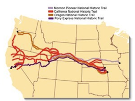
This overview of the National Trails map from the National Park Service shows how many of the trails overlapped. Only as they came up against the Rockies did they fork their own path.

It’s sometimes difficult to admit how little I know about U.S. history. I knew that people moved west, that gold was an important lure, and that the journey was a hardship. I knew there were trails people followed. I even knew some of the trails’ names: Oregon Trail, Santa Fe Trail, and California Trail. However, ask me details of any particular trail and I’d have told you nothing important.

After visiting the National Trails Headquarters I know enough to learn more! There in Omaha City I picked-up a few maps, I toured the museum facilities, I talked with Rangers. I learned the basics and committed myself to learn as opportunities presented themselves. It wasn’t long before I could do just that when I was headed south through Wyoming. It was then that I found three important milestones along the trails, two of which are described below. 
linkedinmailby feather
Categories
Mountain Road Travel

A Devil of a Tower

Devils Tower
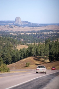
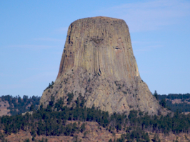
Devils Tower stands out as distinct and special. There’s nothing else like it anywhere around and you’re drawn towards it. It has the same allure today that it had for Indians centuries long ago.

Look closely. You can see the claw marks left by the bear as it tried to climb up the surging column of ground that rose up to protect the fleeing maiden. The indian gods had protected her from attack of the savage beast and she rested safely atop until it was safe to descend. That’s indian lore surrounding Devils Tower; its distinct character cries out for definition.

Devils TowerIf Mt. Rushmore was out-of-the-way then Devils Tower was in the middle of nowhere. However, the logic in my head went something like this … “Will I ever have a better opportunity to visit this site?” The answer wasn’t likely to be yes so I took the detour. I visited the first-ever National Monument.

As you first see it in the distance there’s no mistaking where your’e headed.

The natural forces that caused this upsurge were quite distinct. The result is a mysterious rock formation. Around its base is a path along the treeline, great for walking to see the tower from all sides. While that was certainly enough for me, as you can see in these pictures, it wasn’t enough for everyone.

Below are four pictures of people climbing the tower.

linkedinmailby feather
Categories
Cave Desert Mountain Road Travel

South Dakota National Parks

Rushmore

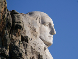
This profile view of George Washington is one I hadn’t seen before and which under these lighting conditions looks quite good. Pat on the back complete. I chose it for its distinction.

Mt. Rushmore is the most notable destinations. Vaguely I knew of Badlands but I’d not even heard of either Wind Cave or Jewel Cave. Not surprisingly, since they’re all National Parks, I found them really worthwhile visits.

This set of parks is the primary reason I traveled so far north on my way to Los Angeles. Mt. Rushmore was my prime attraction. Its not that I reeeeeally wanted to see four Presidents’ heads carved in the side of a mountain. Superficially Mt. Rushmore sounds kind of goofy, kind of like an attention-getting stunt. Of course I was wrong. It’s a National Park for a reason!

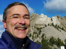
RushmoreThis site pays homage to some of the U.S.’s greatest leaders. It’s sedate and respectful and the carvings are huge! I learned about the site’s construction and of the many difficult challenges they had to overcome during construction. Distinctive subtleties were interesting such as how the create a “glint in the eye” effect (by using pillar protrusions in each pupil). Plaques on display along the walking trail explain the history and the significant contributions of the four   Presidents. I didn’t think that Washington, Jefferson, Roosevelt (Teddy) and Lincoln all had big heads … but now I know better! See pictures below. 
linkedinmailby feather
Categories
Road Travel

Giants on the Rampage

Giant Rampage
In the mid-20th century when roads were new and businesses needed to attract traffic, roadside attractions were everywhere. It’s been this way on every legacy highway I’ve driven and here we see it again. Roadside giants!

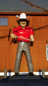
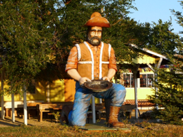
The path from Rapid City, SD to Mt. Rushmore is well traveled and has been for decades. Giant RampageAlong the way the road passes through many communities which depend on the tourist trade. Not normally a sucker for kitsch, when I see a roadside giant I can’t help but pull over. This drive afforded two chances to get up close to some giants, one with the Muffler Man heritage which can be identified by a few distinguishing features.

These fiberglass giants were created to attract attention and build business. Muffler Men appeared outside gas stations. The Uniroyal Gals appeared outside tire shops. Other large chains that used fiberglass figures include Big Boy and A&W Root Beer. Giants also appeared as lumberjacks, indians, construction workers, cowboys, and more. Custom work made to order would be done by the California fiberglass company which created most of these figures but often to save costs they’re reuse molds. Hence many have similar distinguishing features such as the spread legs, the hand positions, and the square jaw. You can learn the history of these figures and read an interview with their producer here.

UPDATE: 

linkedinmailby feather
Categories
Historical Museum Road Travel

Lincoln’s Boyhood Home

Lincoln Boyhood Home
At 15 feet square this isn’t a McMansion! It’s amazing that upwards of a dozen people lived in this small space. This home was the last of four built on this site in Indiana. From here he moved to IL.

What is it with me and President Lincoln? I’ll chalk it up to coincidence that I got interested when I was in the right place (his birthplace) at the right time (his 200th birthday) and attended his birthday party and new-penny launch. Revisit my awakening here.

First there was his birthplace and childhood home in Kentucky. Then there was his boyhood home in Indiana. Then he called Illinois Lincoln Boyhood Homehome from age 21 till eventually he moved to D.C. as President. I recount all this because 1) it details my personal odyssey and 2) it shows that anyone who can lay claim to one of our greatest Presidents does.

This visit was to his boyhood home where he grew up, worked on the farm, and learned the knowledge and values which would eventually define the man he became. It was from age eight to 21 that he lived here after leaving the farm they had started in Kentucky due to a property ownership dispute.

linkedinmailby feather
Categories
Museum River Road Travel

Cincinnati Lights

Cincinnati Lights
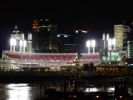
Good fortune put me on a bluff across the river at night with the Reds baseball team in action. Lights were a blazin’! Cincinnati truly is a photogenic city (yes, as in “light emitting”).

This town is photogenic. A few months ago I was passing through and took note of it’s appealing character: the winding Ohio River, it’s many bridges, hills all around, and a beautiful skyline. I knew it had the makings of a photo shoot and I had it in mind for a revisit … this was it.

The Cincinnati Museum Center has a scale model of the city which is where I started to piece together my picture-taking ambitions. Foremost I wanted to capture some contemporary views which I could superimposed over identical historical images. This I didn’t manage to pull off; too ambitious. However, with all the buildings, bridges, river, hills and lights my second ambition was to get some skyline shots. This I did and I had a blast trying to sight my shots.

Cincinnati LightsWhile I didn’t get to a few of the better vista points  I did get enough good pictures to come away happy. Finding the night baseball game in process was a real coup!

The next morning was cloudy so after visiting the sites I’d missed at night, I hit the road.

Above you can see what I missed; shooting that would be lovely at night!

I feel a return engagement is inevitable.

linkedinmailby feather
Categories
Road Travel

Westward Ho!

Westward Ho
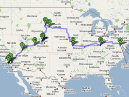
Beth suggested that an overview of my route would be appropriate. I’ve obviously not taken the shortest path but to see new sites I need to go out of my way on this 4,000 mile drive west.

I don’t drive across this continent without a plan. It may be hastily contrived and it may be incomplete. It may be only a sketch when I walk out the door but it’s going to mature quickly and it’s going to result in a great time if history is any indication. This is the story of such a trip.

It starts with a primary destination. In this case it is Catalina Island off the coast of Los Angeles where I would attend the four dayJazzTrax Festival. In honor of Ken Burns’ series, my goal going to and from the west coast is to visit National Parks and Monuments. Since it is still early fall and the weather hadn’t turned cold, I’ll take a more northerly path than usual. At the heart of it, this is my plan. Pretty loose, eh?

Well, as you’ll see, the details will flesh-out as I go “Westward, ho!

(Actually I named this trip after a camp I attended in 3rd and 4th grades.)

linkedinmailby feather
Categories
Bike Hike Mountain Road Travel

The AT: My Two-Hike Overnighters

Butterfly
Though I don’t pay much attention to them, there is a huge variety of insects to be seen along the trail. One of these hikes I’ll need to focus on them but until then I’ll just keep avoiding them underfoot.

First it was an idea and then an accomplishment. Within 24 hours I hiked 22 miles and biked 17.5 miles and in between I slept like a log on Loft Mountain. This took me half way through the South District of Shenandoah. My second time out I hiked an even more ambitious 23.1 miles and biked 22.1 miles while collapsing at a Days Inn overnight. I was going out with a bang! (Or a thud!)

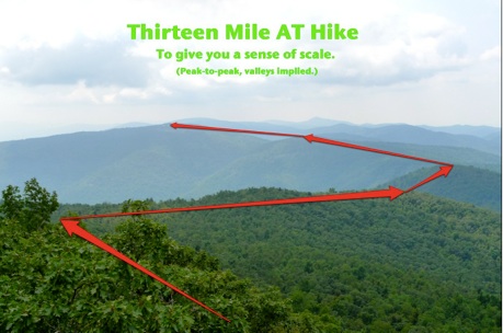
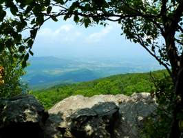
Allow me to give you a feel for what a day hike along the AT is like. The picture below I took early on my first day. From this view point you can see Loft Mountain in the distance. Over hill and dale the day’s hike was 13 miles and this is what it looked like. Good thing I didn’t expose myself to this ominous prospect too often or I might have given up!

 13 Mile Hike
linkedinmailby feather
Categories
Bike Hike Road Travel

The AT: Two More Hikes Down

AT - Two More Hikes Down
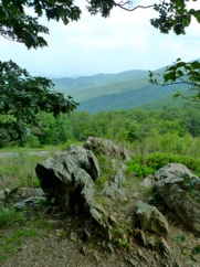
The haze and the foliage conspire to create a sense of “softness” to views from atop Shenanadoah NP. Rather that resent its fogging affect in photography I’ve come to enjoy the mood that it sets.

Rocks. They stand in stark contrast to the misty softness which pervades the park and rocks define some of her most interesting features. Three I’ve hiked are Old Rag Mtn, Stoney Man, and Bearfence Mountain. All three are excellent examples of this.

AT - Two More Hikes Down 1

This week I hiked twice. Once took me past my half-way point, from Hawkbill Gap to Booten Gap (10.2 miles). Another took me to the two thirds marker at Swift Run Gap (11.3 miles) where US 33 crosses the park. With four more day hikes I’ll achieve my goal and be in Waynesboro!

The AT in Shenandoah is at a high altitude and is usually much cooler than the surrounding lowlands. This explains why it was a popular get-away for the rich and the powerful in D.C. before the days of airconditioning. This week has been particularly pleasant for hiking as it’s been unseasonably cool and dry. My first hike started at 64 degrees; my second hike at 59 degrees. On neither day did the temp break above 80. 

linkedinmailby feather
Categories
Historical Lake Lighthouse Museum Road Travel

Taste of Chicago

Chicago - 0
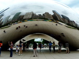
Cloud Gate is a giant jellybean of highly polished steel. In its reflection you can see the Chicago skyline along Michigan Avenue. It’s hard not to walk around it an be amazed.

Last year while returning home via the Lincoln Highway, our nation’s first transcontinental road which ran from Manhattan to San Francisco, I stayed in Chicago just as “Taste of Chicago” was winding down. “Wow!” I thought “I’ve got to get back to see this next year!” And so I did.

“Taste of Chicago” is a nine-day food and performing arts festival which takes place in Grant Park along Chicago’s waterfront. This is a big deal! All the music concerts are free and included such acts as Hootie and the Blowfish, Barenaked Ladies, Buddy Guy, and much more. To get a sense of scale, take a look a the map below. For food alone there were 56 restaurants! 

linkedinmailby feather