Categories
Lake Lighthouse Museum Road Travel

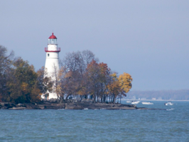
Lights along Lake Erie’s South Shore

Lights along Lake Erie
I’m guessing that boating in Lake Erie is simply safer based on the number of lighthouses. Again, I didn’t go all out to find them all but I visited five and that was around one third of the circumference.

To complete my navigation of the U.S. side of Lake Erie I needed to drive from Detroit to Erie (perviously I’ve driven the Erie to Buffalo stretch). However, I woke up in Ann Arbor and there was no way I wasn’t going to tour the University of Michigan, visit the Ford Library, and go shirt-shopping for my girls. Since bed that night was south of Pittsburg I needed an early start and many hours behind the wheel. I’m homeward bound!
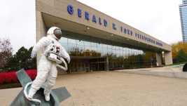
Lights along Lake ErieSince age 16 when I worked on the Ford for President campaign I’ve been a fan. Three day earlier I had visited his President Museum in Lancing and was very impressed. It’s very well done. While there I learned of the Library in Ann Arbor so I made it my first stop. It’s much smaller, not nearly so well done, but equally supportive and respectful of President Ford. My favorite part was the corner he used for his personal office till the end.

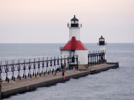
As for the lighthouses, they’re below. You look, I’ve got lots of driving to do!
linkedinmailby feather
Categories
Historical Museum Road Travel

The Heart of U.S. Manufacturing

Manufacturing
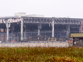
Wish I could say that demolition like this was hard to find but it wasn’t. It was all over the place. Most sites were already leveled but several were in process. I saw the car industry crumbling.

All my life I’d heard about the manufacturing might of the automotive industry in Michigan. In recent years I’ve also read about plant closures. I recognize but know nothing about towns such as Pontiac, Detroit, Flint, Troy, Livonia, Flat Rock, Ypsilanti, etc. I was in the heart of Michigan and wanted to see this for myself so I mapped out a route and drove it.

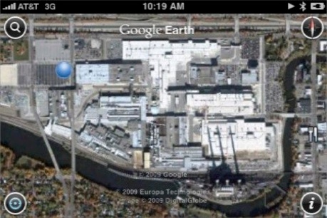
First I wanted to see the scale of car plants. I drove around with my iPhone showing satellite views of my route. When I saw a large facility I’d drive toward it, position myself in the image (the blue dot), and snap a picture. Here are some examples and WOW they’re impressive.

Manufacturing

linkedinmailby feather
Categories
Bridge Lake Lighthouse Road Travel

Two Days of Lighthouse Hunting

Lighthouse Hunting
Range lights allow ships to head straight into port. By navigating a course where the two lights are aligned, one atop another, they know their heading is true. Low tech aid of great value to mariners.

Why do I chase these things? Why are most people intrigued by lighthouses? They’re usually remote and always isolated. Most structures are unique if only by variation on a theme. Lighthouses are always near the water and usually in distinct settings. They serve an exotic purpose, guiding ships away from danger. The lifestyle of keepers was one of loneliness and monotony, yet in the worst of weather their commitment to duty was most important. The fact that theirs is a disappearing way of life only adds to make the mix a big draw. Somewhere in all this is why I chase lighthouses.

So around Lake Michigan I went hunting. Not fixated on numbers this time, I just enjoyed getting to those that I could and paying particular attention to the noteworthy. Along 3/5th of Lake Michigan’s coastline I visited 24 of the 118 total lights. It was fun.

linkedinmailby feather
Categories
Falls Lake Lighthouse River Road Travel

Across the U.P. to Canada

Upper Peninsula to Canada
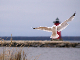
Sought out the lighthouse, found lots of bird activity, decided to combine the two in one picture. Many, many shots later I was able to realize my vision. Good results often come only after much persistence.

The Upper Peninsula of Michigan was just about the last place I’d ever get to. It wasn’t on the way to anywhere; it’s not near where I live; I don’t know anyone who lives there. This was my chance! My plan was to follow the coast of Lake Michigan with only two detours: 1) Whitefish Point Lighthouse and 2) Sault St. Marie in Canada. That night I’d rest my head near the Macinack Bridge which connects the two great peninsulas of Michigan.

Just as I entered Michigan I picked-up a map and guide to all of Michigan’s 118 lighthouses at the Visitors Welcome Center. Did you catch that? 118! Unlike other lighthouse trips to Maine and Oregon and Prince Edward Isle, I wasn’t going to try and see them all. This trip was my UP experience and time was limited. I was going to focus on the easy and the interesting lights. <fix>

linkedinmailby feather
Categories
Lake Lighthouse Road Travel

Wisconsin has a Thumb!

Wisconsin Thumb
Atop a tower built in 1932 which stood 225 feet above water level I had a commanding view of the surroundings. The sun was perfect, the air was clear, and, but for the fact I was freezing, it was perfect.

I spent the day learning the basics of Wisconsin and Green Bay then shooting up the Door Peninsula to visit Potawatomi State Park, Sturgeon Bay, Cana Island Lighthouse, up to Northport where ferries depart to near by islands. This peninsula protrudes east into Lake Michigan, as if Wisconsin’s thumb.

In Green Bay I visited the Railroad Museum and Neville Public Museum where I focused to learn local history. Everyone knows Wisconsin is all about cheese making, brewing, and lumber but who knew that Green Bay was once very big in ice farming!? Football was big in Green Bay where the legacy of Vince Lombardi’s Green Bay Packers lives on to the present.

Wisconsin Thumb

linkedinmailby feather
Categories
Road Travel

Who Says Fargo’s Not Interesting?

Fargo
A technique I learned from watching magicians is called “distraction”. This picture has nothing to do with my favorite site in Fargo. It’s not even in Fargo but across the river in Moorhead. Ha! I distracted ya!

There’s a technique I learned in my early days of making speeches. It’s called “progressive disclosure”. The idea is I only show you want I want you to see at any given moment. I’m going to use that technique here with my favorite spot  in Fargo. These pictures are taken of the Hotel Donaldson at the corner of First and Broadway in downtown Fargo. Please scroll down and learn how citizens of Fargo apply their creative energies.

linkedinmailby feather
Categories
Road Travel

Roosevelt’s Badlands North

Badlands
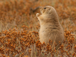
They’re cute and in great abundance as you drive through the park. Fields with prairie dog holes are everywhere and most of them have occupants who pop in and out to eat and chatter with neighbors.

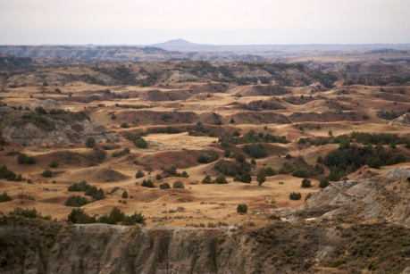
Badlands are aptly named because they’re bad for farming, they’re bad for grazing, and they’re bad for traversing. They’re just bad land, unless you’re a photographer that is. The rough terrain, exposed colors, and abundant wild life make for good shooting. The Badlands National Park is due south and can be seen here from earlier in my trip. These are badlands but a part of Theodore Roosevelt National Park which are the subject of this post.

Badlands

Above you can see evidence of this land’s “bad” character.

linkedinmailby feather
Categories
Animal Bridge Canyon Falls Lake Mountain River Road Travel

Impacted by Road Construction

Yellowstone Road Construction
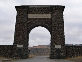
The Roosevelt Arch at the north entrance to Yellowstone was dedicated by President Teddy Roosevelt in 1903. He happened to be vacationing in the park at the time and came to lay the cornerstone of this now-famous gateway.

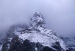
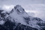
By the time I arrived at Grand Teton National Park it was getting dark but the peaks and the clouds cast a mood worthy of shooting. This disappointed me somewhat as I know from previous visits how beautiful these mountains can be. No matter, I planned on spending lots of time in the area over the following day. Little did I know that road construction would prevent me from getting back to these commanding peaks.

Yellowstone Road ConstructionYellowstone Road ConstructionYellowstone Road Construction


Yellowstone Road ConstructionLike a man on a mission I shot north through the Tetons, inched along the Rockefeller Parkway (which was being resurfaced) and wound my way through Yellowstone National Park in pitch darkness to the north entrance. My mission? To get some sleep, some food and some gas. When I finally got to Gardiner, MT I checked in to my motel and found food and gas at the only store open in town, five minutes before it closed. Whew!
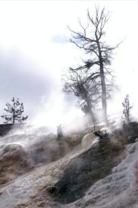
I love Yellowstone and wanted to see as much as possible. The road network in the park is shaped like a figure “8” with radials heading off to five different entrances. During a very long day I covered it all save one road segment and one entrance which were both closed due to road construction. Though I didn’t do much hiking, I did see a lot, and it reinforced in me a feeling of awe. By late evening I had made it out the east entrance, through Cody WY and to my hotel in Billings, MT.

linkedinmailby feather
Categories
Bridge Canyon Hike Road Travel

Walking on the Moon

Craters of the Moon
Eerie and desolate. That’s how I’d describe the lava fields of Craters of the Moon Monument. Little lives in the lava, its treacherous to traverse, and it goes on for tens of miles. Such a strange place! Tuesday, October 20, 2009

Upon leaving Portland my goal was to get home swiftly which meant lots of mileage and few stops each day. I pretty much flew nonstop from Portland past Boise and settled for the night in Twin Falls. The problem was that there were many temptations locally and I had only planned on a couple of them. Seems it was going to be another loooong but enjoyable day.

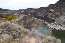
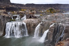
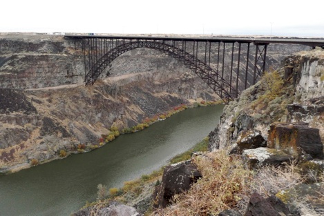
The Snake River cuts a canyon through southern Idaho as it winds its way to join the Columbia River. Great vistas, water falls, and impressive bridges abound in here where Evil Knievel made his failed attempt to jump the gorge. Here’s a nice sample of what can be seen right around Twin Falls:

Twin Falls Snake RiverTwin Falls Shoshone Falls


Twin Falls Perine Bridge


linkedinmailby feather
Categories
Bridge Canyon Falls Family River Road Travel

Columbia River Gorge

Columbia River Gorge
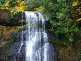
Waterfalls are a natural when water falls (rain) on mountains and hills (Cascade mountains). One location, Silver Falls State Park, has ten magnificent falls all within a four hour hike.

At the end of the last ice age, water from Glacial Lake Missoula found it’s way to the sea by bursting through the Cascade mountain range at the point we now know as the Columbia River Gorge. Who knew?!

Again, I learn through my travels and I found this insight fascinating. No wonder rivers plunge hundreds of feet forming world-famous waterfalls. No wonder the gorge walls can climb as high as 4,000 feet straight up. No wonder this river-to-the-sea is so mighty. It’s all due to the residual impact of floods from a melting glacial lake over 12,000 years ago!

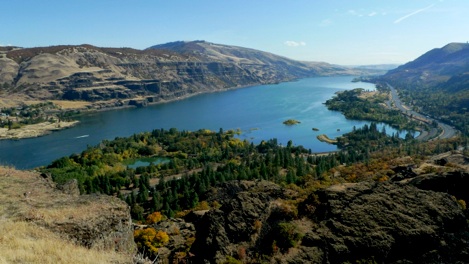
Just look at the majesty of the eastern entrance to the gorge … glorious.

Columbia River Gorge

Before the melting flood broke through, this canyon didn’t exist.

linkedinmailby feather