Categories
Bridge Canyon Mountain River Road Travel

Four Gems Against the Odds

Four Gems Against the Odds
Famous for the high path it travels and for its steam locomotion, I knew the C&T was idle for the season. Regardless, I had hoped to drive the route. No go. The pass was closed to all traffic due to snow.

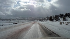
My plan was to drive west along the far north of New Mexico to Farmington. The remarkably useful NMroads.com showed snow had closed many roads. I couldn’t do the Enchanted Circle. I couldn’t drive north from Chama. Neither could I go along a key stretch of scenic route as I had hoped to. However, as evidenced by the fact that I’m typing this in Farmington, with patience and lots of detours I arrived and the day was a success.
Four Gems Against the Odds
Taos to Farmington

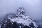
I drove through snow, hail, rain, and sun. I drove over ice, packed snow, slush, and dry pavement. The changes in weather and elevation and sunlight brought delight to the photographer in me. Never did I feel endangered but I always remained cautious. Today I drove through a picturesque New Mexico Weather Wonderland!
linkedinmailby feather
Categories
Animal Bridge Canyon Falls Lake Mountain River Road Travel

Impacted by Road Construction

Yellowstone Road Construction
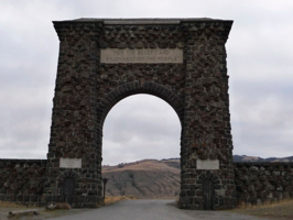
The Roosevelt Arch at the north entrance to Yellowstone was dedicated by President Teddy Roosevelt in 1903. He happened to be vacationing in the park at the time and came to lay the cornerstone of this now-famous gateway.

By the time I arrived at Grand Teton National Park it was getting dark but the peaks and the clouds cast a mood worthy of shooting. This disappointed me somewhat as I know from previous visits how beautiful these mountains can be. No matter, I planned on spending lots of time in the area over the following day. Little did I know that road construction would prevent me from getting back to these commanding peaks.

Yellowstone Road ConstructionYellowstone Road ConstructionYellowstone Road Construction


Yellowstone Road ConstructionLike a man on a mission I shot north through the Tetons, inched along the Rockefeller Parkway (which was being resurfaced) and wound my way through Yellowstone National Park in pitch darkness to the north entrance. My mission? To get some sleep, some food and some gas. When I finally got to Gardiner, MT I checked in to my motel and found food and gas at the only store open in town, five minutes before it closed. Whew!
I love Yellowstone and wanted to see as much as possible. The road network in the park is shaped like a figure “8” with radials heading off to five different entrances. During a very long day I covered it all save one road segment and one entrance which were both closed due to road construction. Though I didn’t do much hiking, I did see a lot, and it reinforced in me a feeling of awe. By late evening I had made it out the east entrance, through Cody WY and to my hotel in Billings, MT.

linkedinmailby feather
Categories
Bridge Canyon Hike Road Travel

Walking on the Moon

Craters of the Moon
Eerie and desolate. That’s how I’d describe the lava fields of Craters of the Moon Monument. Little lives in the lava, its treacherous to traverse, and it goes on for tens of miles. Such a strange place! Tuesday, October 20, 2009

Upon leaving Portland my goal was to get home swiftly which meant lots of mileage and few stops each day. I pretty much flew nonstop from Portland past Boise and settled for the night in Twin Falls. The problem was that there were many temptations locally and I had only planned on a couple of them. Seems it was going to be another loooong but enjoyable day.

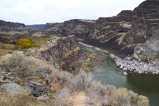
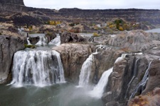
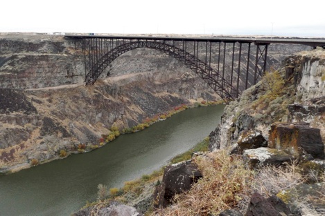
The Snake River cuts a canyon through southern Idaho as it winds its way to join the Columbia River. Great vistas, water falls, and impressive bridges abound in here where Evil Knievel made his failed attempt to jump the gorge. Here’s a nice sample of what can be seen right around Twin Falls:

Twin Falls Snake RiverTwin Falls Shoshone Falls


Twin Falls Perine Bridge


linkedinmailby feather
Categories
Bridge Canyon Falls Family River Road Travel

Columbia River Gorge

Columbia River Gorge
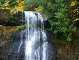
Waterfalls are a natural when water falls (rain) on mountains and hills (Cascade mountains). One location, Silver Falls State Park, has ten magnificent falls all within a four hour hike.

At the end of the last ice age, water from Glacial Lake Missoula found it’s way to the sea by bursting through the Cascade mountain range at the point we now know as the Columbia River Gorge. Who knew?!

Again, I learn through my travels and I found this insight fascinating. No wonder rivers plunge hundreds of feet forming world-famous waterfalls. No wonder the gorge walls can climb as high as 4,000 feet straight up. No wonder this river-to-the-sea is so mighty. It’s all due to the residual impact of floods from a melting glacial lake over 12,000 years ago!

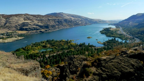
Just look at the majesty of the eastern entrance to the gorge … glorious.

Columbia River Gorge

Before the melting flood broke through, this canyon didn’t exist.

linkedinmailby feather
Categories
Canyon Falls Mountain Road Travel

Yosemite Rain, Rocks, and a Flat

Yosemite Rain
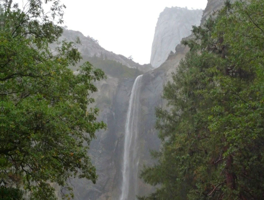
A good thing about rain is that it makes rivers flow which brings water falls to life. My visit was filled with an abundance of waterfalls in peak form. If only my camera had been waterproof ...

Yosemite shouldn’t be remembered for floods, landslides, and car troubles but all these conspired to make my visit memorable. While at Kings Canyon I was aware that bad weather was coming but I still harbored hopes of hiking to the top of Half Dome and taking wonderful pictures. By the time I awoke the storm was in full force and by the time I left I was driving a hobbled car. 

linkedinmailby feather
Categories
Canyon Mountain Road Travel

Kings Canyon and Amazing Sequoias

Kings Canyon
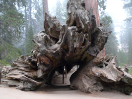
This fallen Sequoia was so big that I could walk through its hollowed core without ducking. They’re believed to be some of the world’s oldest living creatures with ages going back over 3,000 years!

The season’s first snow storm was moving in so the weather wasn’t the best but it was good enough for a glimpse at why these parks are special. The parks were Sequoia NP and Kings Canyon NP, they’re sort of commingled with shared borders, they’re just south of Yosemite and relatively unknown.

Kings Canyon General GrantKings Canyon General Grant

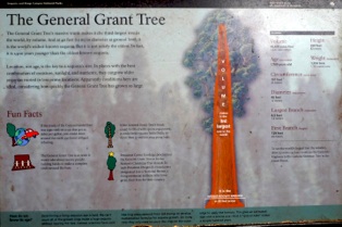
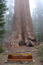
The General Grant Tree was proclaimed the Nation’s Christmas Tree in 1926. It’s the world’s third largest tree, has a 40 foot diameter, and is 1,700 years old. That makes it relatively young compared to many others. Wow!  These trees are amazing! The grove where this great Sequoia stands is in King’s Canyon National Park. See what I mean when I say the parks are commingled?

linkedinmailby feather
Categories
Canyon Mountain Road Travel

Fiery Surprises You’ve Never Heard Of

Fire Valley
While in red rock country I wanted to force myself in to new territory. State parks turned out to be surprisingly compelling. Guess the NPS doesn’t have a monopoly on grandeur after all!

Ever heard of Black Dragon Canyon? The Valley of Fire? Snow Canyon? Neither had I but they were along my route, AAA recommended them, and  so I visited. I should have guessed they’d astound as they’re neighbors to other red rock greats. Because it left such a strong impression on me I also revisited Cedar Breaks National Monument where again I was taken aback.

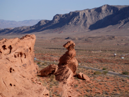
Valley of Fire

Above you see just a tease of what Valley of Fire has to offer. The formations and colors were much more varied than at most parks. From jagged ranges to soft flowing rock, from intense rust red to pale beige, this place was a tightly packed jumble that was fun to explore. 

linkedinmailby feather
Categories
Canyon Hike Mountain River Road Travel

Brilliant Red Utah

Brilliant Red Utah
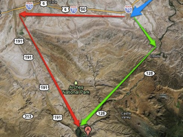
After close inspection of satellite images, the green route from Grand Junction looked more interesting than the red route. Good choice! I had stumbled on to the Dinosaur Diamond Prehistoric Highway.

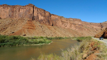
My next stop was Moab, UT where I was going to deliver a box of DVDs to the parents of a friend. Old favorites such as Arches and Canyonlands were also on my agenda as were new recommendations such as Dead Horse Point. Little did I know that an interesting-looking shortcut would drop me into the Colorado Riverway Recreation Area, another wonder of red rock and water.

To a great extent I’m going to let pictures convey the grandeur of the area. However, before I set you free on my albums I want to make two points. First, the rock really and truly is a beautiful shade of red. Second, the combination of blue sky, red rock, and green plants combine to make magic. The Colorado River is what makes this possible in Utah’s arid plateau.

Brilliant Red Utah
Colorado National Recreational Area

I could spend a month in this region and not begin to do it justice.

Guess I’ll just have to keep returning!

Enough! Let’s see some pictures!

linkedinmailby feather
Categories
Canyon Hike Mountain Road Travel

Colorado National Monument

Colorado National Monument
Deep, northward-facing gorges characterize the park. Its orientation and depth made for long shadows and difficult photographic challenges. Better perhaps to visit in summer at high noon.

The expanse of these canyons is impressive. They’re wide and deep and intensely colorful. However, the gorges are north-facing and they’re viewed from a road that runs along the rim. As a photographer I was disappointed with my timing. I arrived in the autumn in the late afternoon when shadows were long and much of the beauty was obscured in relative darkness. Though I’m glad I went, it was a disappointing photographic experience.

linkedinmailby feather