Categories
Camp Hike Mountain Travel

Hiking the Trans-Catalina Trail

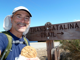
Travis on the TCT
Happy to have succeeded I rewarded myself with a giant cookie from the Airport Cafe. It’s a little mental motivation I gave myself to finish the Trans-Catalina Trail. Another great adventure complete!

The trail was 38 miles long but I hiked over 45 to make it happen. From the top of Catalina at Starlight Beach to the bottom at Pebbly Beach I hiked and hiked and hiked. Logistics were a bit of a challenge. Weather interrupted my progress for a day. However today I completed my goal: I hiked the TCT!

So how did this compare with other hikes? I was surprised by how difficult the trails were and it took me a while to figure our why. I’ve hiked many steep mountains but they rarely have felt this challenging. Then it struck me. Those who designed the TCT very rarely used switchbacks to make climbing easier. Instead they simply took you straight up a mountainside which, of course, is shorter but takes much more effort. But for the 35 pound pack on my back I wouldn’t have minded.

I’m not going take you on a blow-by-blow of my days of adventure. It was in many ways a walk across a desert island with sea and sky almost always in view and more often than not the coastline too. There were animals I did not recognize, bison often too close for comfort and beautiful landscapes. 

I leave you with my favorite impressions: harbors, beaches and coves.

linkedinmailby feather
Categories
Camp Hike Mountain Ocean Travel

Camping with Pirates at Two Harbors

Pirate Pier
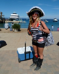
I did not expect to find hundreds of pirates when I arrived in Two Harbors. Sure, it was the end of Buccaneer Days but I had no idea the zeal to which people got into costume. There was “Argh” aplenty!

Camp sites had been unavailable prior to my arrival. This harbors town in the north of Catalina Island was flooded with 3,000 visitors from the mainland. With no more than a hand full of hotel rooms in the area, everyone had to camp. Not till they left could I reserve a space. Today I caught the exodus.

Flirtatious Pirate

Two Harbors was my base of operations at the start of my hike along the length of Catalina Island on a trail called the Trans-Catalina Trail (or TCT). I started my day in Palm Springs, drove to Long Beach for to the ferry to Avalon where I left my festival clothing, and then boarded a bus for the ride north to my campground. The air was thick with tired reverie, hoarse voices and residual inebriation. Buccaneers had come to have a good time with apparent success. I’d come for an entirely different type of good time and hoped to have similar success. The first stop: set up camp.

While dry and dusty, this desert campground was a stone’s throw from the harbor. What a joy to be in such a beautiful setting. As I assembled my tent I could hear sails luffing, metal clanging against masts, and happy boaters winding down their visit. The place would be quiet by night as everyone went back home and I would have the place to myself. 

linkedinmailby feather
Categories
Hike Mountain Travel

Mt. San Jacinto Thunder and Lightning

San Jacinto Thunder
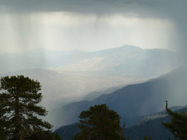
This storm delivered a localized punch. So concentrated was the area of downpour that I could look through it to sunny mountainsides in the near distance ... while I was drenched in heavy rain.

I like being at the tops of tall mountains. However, my preference is to be at the top of the world when there is NOT an electrical storm. This is exactly what swooped in when I was atop Mount San Jacinto.

My focus between Yosemite and Catalina was getting to know Palm Springs. One famous feature of the area I had visited before: Palm Springs Tramway. On that visit all I accomplished was the 6,500 foot ride up the tram, a walk around the visitor center, and a ride back down. This time I wanted to hike to the extra 2,300 feet of elevation to reach San Jacinto Peak at 10,842 feet. 

linkedinmailby feather
Categories
Falls Hike Lake Mountain Summary Travel

Yosemite’s Many Sites

Mary Lake
Some old roads can still be found especially if they serve a modern purpose. The ancient road to May Lake was built early last century. From its condition I’d guess that’s when it also saw its last repair.

Hetch Hetchy, Glacier Point, Tunnel View, Mirror Lake, and a myriad of ancient roads are side trips I took during this visit. Any one of the biggies I’ve written about already would be reason enough come to Yosemite but there’s so much more to see. Some of these are worth setting apart and mentioning.

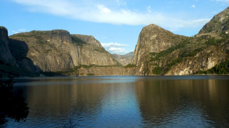
The water supply for San Francisco comes largely from behind a dam built at one of Yosemite’s great canyons. After the 1906 San Francisco earthquake and fire, Hetch Hechy within Yosemite was the wildly controversial selection of location to create a huge reservoir. The city was growing rapidly; it needed a large and dependable supply of water. Not only was water important for daily life but also for fire control. Steps needed to be taken to preempt another out-of-control fire such as the one that destroyed the city.

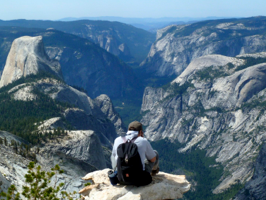
Clouds Rest in Yosemite

linkedinmailby feather
Categories
Bridge Hike River Travel

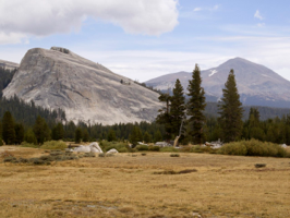
Approachable Tuolumne Meadows

Tuolumne Meadows
Throughout the park are sites named “Flat” or “Meadow” but finding the level spot can be almost impossible. At Tuolumne it was plain as day as the meadows run flat and level and ran very wide.

Tuolumne Meadows is highest easily-accessible area of the park. It’s so high that half the year it’s closed because the roads are impassible due to snow. My last full day was spent in these meadows where glaciers staged themselves for the carving ride down into the valley. Good timing too. It was the Visitors Center’s last day open and all the gift shop items were on sale at 50% off!

What makes Tuolumne Meadows special has to do with its terrain and its elevation. This is the largest flat space in Yosemite and very high at 8600 feet. Still sub-Alpine, trees and grasses grow abundantly and crystal-clear rivers gently flowed through meadows and forests. It was a peaceful place where after visiting you feel refreshed.

My favorite spots were bridges along the Lyell Fork of Tuolumne River. The water there is perfectly clear. The air is crisp and dry. The trees stand tall and strong agains the coming winter. It’s a special place. In addition the path I hiked was part of the Pacific Coast Trail which next to the Appalachian Trail is probably the long-haul trail which most interests me. 

Below you’ll see  pictures taken along my hike and around the meadows. 

linkedinmailby feather
Categories
Hike Mountain Travel

Olmsted Point to the Valley

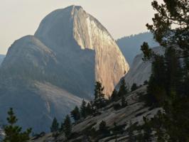
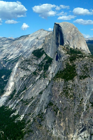
Half Dome from Olmsted Point
I guess I was a little fixated on Half Dome because I seem to have shot it from many angles and in lots of different lighting. This is a late afternoon perspective from Olmsted Point with the sun reflecting off the wall.

Within Yosemite I’d always either hiked around the valley or along the Tioga Road highlands. What I hadn’t done before was hike between the two regions of the park. Today’s hike was designed to make this connection.

The challenge I faced in planning this hike was logistics. I’d have to drive to my trailhead at Olmsted Point, then hike down into the valley, and finally get a bus ride back to my car. Simple enough but for the fact that the bus ran only once per day at 5:00 PM. If I missed it then I’d be seriously stranded as my bus was the very last ride till Spring. To make sure this didn’t happen I’d have to start at a crazy-early hour! Today was shaping up to be a long and worrisome day.

Well, I made it with plenty of time to spare but not until the bus actually let me disembark at my unsanctioned stop did I really heave a sign of relief. The driver was good about being flexible and letting me get off where he shouldn’t have stopped but I got the idea he wasn’t comfortable with the idea. Fifteen hours after leaving my hostel I finally returned to a shower, a delicious dinner and a black and tan beer. Another major Yosemite goal achieved. 

linkedinmailby feather
Categories
Hike Mountain Travel

The Clouds Rest 360

Clouds Rest
When you reach the peak of Clouds Rest you kind of don’t ever want to leave. Lingering here was easy; deciding to leave was hard. Certainly the view from that height makes you think big thoughts!

My friend Michael has spent more quality time in National Parks than anyone I’ve ever met. Better still he’s a photographer with an excellent eye for wildlife and landscape photography. Best of all he’s generous with advice of where not to miss. Clouds Rest was his “Do not miss!” and I’m glad I didn’t.

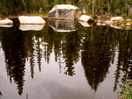
Many of my hikes are to an amazing destination with perhaps a point of interest or two along the way. Yosemite hikes tend to be much richer than my typical hikes but the hike to Clouds Rest was nonstop joy. The trail from Tioga Road lead through sub-Alpine forest, past lovely still waters, and along craggily cliff tops with extended vistas of the park. 

A lovely hike and one I thank Michael for urging me to make.

Below are few scenes from along the way … 

linkedinmailby feather
Categories
Hike Mountain Travel

Cables up Half Dome

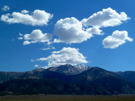
Clouds Over Boundary Peak
As I entered California from Nevada via the remote US Highway 6 I was greeted by this cloud formation over Boundary Peak.

Half Dome is the most famous mountain in one of the most famous parks in the world: Yosemite. It’s vertical-walled front is an incredible challenge for rock climbers while the steep ascent up its backside is an endurance test for hikers.  Whether it’s climbed or hiked, I suspected that conquering Half Dome would an extremely gratifying accomplishment. Now I know.

Just a few facts about the hike up the backside so you can size the challenge. The summit’s elevation is 8,843 feet (2,695 meters). The hike itself gains 4,800 feet (1,463 meters) over the course of the ascent while the distance hiked totals 17 miles (27.4 kilometers) round trip. The highlight of the hike is the final climb between cables to the top of the dome. Not for the faint-of-heart, it’s both scary and physically demanding, but the reward is a 360 degree view of all Yosemite has to offer. Simply stupendous. 
My permit to climb Half Dome was issued for today. However, three days ago I was in NYC with my daughter Kelsey attending Maker Faire so to get here I drove 45 hours in three days. It was my fastest cross-country drive to date but I was intent on making this hike. By 8:00 the next morning I was crossing Merced River and starting my climb up Mist Trail. By 3:30 I’d be back there and feeling weary but elated and deeply appreciative of the beauty that the Yosemite National Park has to offer.


linkedinmailby feather
Categories
Camp Family Hike Mountain River Travel

Training on Iron Mountain Loop

Iron Mountain Loop
Another segment of the Appalachian Trail was part of the Iron Mountain Loop trail. We’ve hiked many stretches but we’ve only made a small dent in the 2,100 mile long granddaddy of hikes.

Kelsey returned from Alaska a seasoned backpacker. Woven into the National Outdoors Leadership School programs are outdoor education, survival training, and leadership development. The program was conducted over the course of a month-long hike with heavy backpacks that were carried over 100 miles. It’s trial by fire and she learned a lot. This outing was about knowledge transfer: Kelsey to me.

Coming up soon I have several hikes planned. One is a four-day hike along the length of an island just off the coast of Los Angeles on a trail called the Trans-Catalina Trail. It’s relatively new and is 38 miles long though it’s a logistics challenge because it’s remote and support resources are few. Consequently, if I want to hike the trail I’m going to have to backpack and Kelsey was going to train me. 

linkedinmailby feather
Categories
Camp Family Hike Travel

Test Flights from the Nest

Kelsey Old Rag
Lots of firsts in the lives of our young ladies. Kelsey climbed to the first plateau of Old Rag with Beth and then continued on her own to the peak. Their flights from the nest are more frequent, more daring and for longer periods

Summers used to be a time when our local swimming pools came into focus and where the girls would play, socialize and work. Now they’re where I go do laps while they galavant around the country. How things have changed!

Courtney spent the summer in Los Angeles working for Southern California Edison in their real estate department. Among other things, her group contracted for land rights to bring energy from remote renewable energy generation plants to the populations of SoCal. This meant learning about how wind, solar, and geothermal energy makes its way to the homes and businesses that consume it. Her experience was right in line with her interests and her degrees in Environmental Science and Economics. After living on the campuses of USC and UCLA she returned in August for her final semester before graduating.
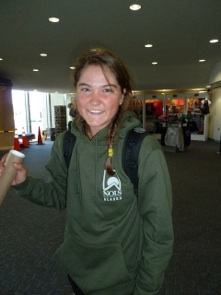
Kelsey didn’t go work in a major city with warm days and sunny beaches. Quite to the contrary she went to the middle of nowhere into the cold mountains of Alaska for a month-long backpacking trip. Along with 14 other 16 and 17 year olds she arrived in Anchorage then disappeared into the wilderness with three NOLS instructors and with supplies on their backs. A month later they emerged with great stories to tell, new skills and maturity, and some deep-quality friendships. Now apparently she’s an “outdoor girl” as she enters her Senior year of high school and starts applying to colleges.

What do I think of all this? Well, I wouldn’t be honest if I didn’t admit that it causes me angst to see them flirting with leaving the nest. Courtney by most measures is gone already and Kelsey is champing at the bit to do the same. Not that they don’t love us; it’s natural to want to sample the world. They’re both adventurous girls who we’re immensely proud of but that doesn’t mean that it’s easy watching them go.

We will survive and there are always grandkids to look forward to. 🙂

linkedinmailby feather